Saturday, March 15, 2008

Tornado startles Atlanta!

Tornado startles Atlanta


The Atlanta Journal-Constitution
Published on: 03/15/08

Visitors, conventioneers visibly shaken

One of the most visible casualties of Friday's weather wrath was the Thomas P. Hinman Dental Meeting. Thousands of attendees were turned away Saturday morning from the Georgia World Congress Center.

Several recounted Friday night's trauma.

"The wind just kept getting faster and faster and louder and louder," said dentist Doug Clepper of Augusta. He and his wife took the fire escape downstairs from their 10th floor room in Omni Hotel.

"It was very surreal. People were dressed up for parties. Women were crying," Clepper said.

The storm was a huge blow to an estimated 24,000 exhibitors, speakers and professionals attending the dental show.

The GWCC roof had heavy damage. Exhibitors faced the task of trying to remove exhibits, some of them large, after the cancellation.

Outside the GWCC, a dozen tables and umbrellas were a tumble of plastic.

Throughout the CNN, Omni and GWCC complex, workers cleared glass and debris. Twenty-foot sections of metal roofing lie twisted in parking lots. Insulation was left hanging in trees outside CNN. Dozens of windows at the Omni were missing.

The CNN atrium was closed Saturday morning.

Outside CNN and the hotel were several parked cars, windows blown out by the force of the winds.

Terrell Brown of Centric Orthodontics of Marietta said the postponement of the Hinman meeting could mean thousands of dollars in lost revenue for companies that sell their products at the show.

"To lose a full day could cost you a third of your projected revenue," Brown said.

Timmi Hagan and Kori Singleton of Macon were attending the Hinman meeting and staying at The Glenn hotel on Marietta street.

They rushed to a closet when the tornado came through late Friday.

"We saw people running," Hagan, a dentist, said. They feared the window to their room would shatter, but it did not.


A building on Nassau Street adjacent to Techwood Drive crumbled onto nearby cars when Centennial Park, CNN Center and the Georgia Dome were damaged. Ben Gray/AJC

Also See More photos: Gallery 2, Latest story | More Weather photos

NWS PEACHTREE CITY, GEORGIA

The tornado that left behind extensive damage packed winds up to 130 mph and was rated an EF-2 storm, said Lance Rothfusz, the meteorologist in charge at the National Weather Service office in Peachtree City. Story

During Alabama and Mississippi State SEC tournament basketball game a tornado may have hit the Georgia Dome.


MARITIME NOTES


Messing About In Ships Podcast


RS

Friday, March 14, 2008

Stamps honour heroes of the sea

Stamps honour heroes of the sea

A new set of Royal Mail special stamps pays tribute to those whose courage and bravery saves hundreds of lives each year.

The six stamps, 'Mayday – Rescue at Sea', issued on Thursday, March 13, highlight the actions of the men and women of the Royal National Lifeboat Institution (RNLI) and the Maritime and Coast Guard Agency (MCA) who regularly risk their lives attempting to save those of others.

This year is also the centenary of the adoption of the SOS distress signal and to mark the anniversary, Royal Mail worked with Walsall Security Printers to re-create the famous sequence of 'dots' and 'dashes' along the top and bottom edges of the stamps.

But the real drama begins on the stamps, with action photography capturing actual rescues and training exercises – some in the harshest of conditions - from around the UK, and graphically displaying the full range of skills of both organisations and their range of lifeboats and helicopters.

Julietta Edgar, Head of Special Stamps, said: "We felt it was vital to capture the incredibly testing conditions the men and women of the RNLI and the MCA often work under for the stamps to have the best impact.

"The new stamps are a special tribute to the life-saving organisations and will be seen by countless people on letters and parcels around the world. We hope they will remind us all of their immense courage and bravery."

WEATHER NOTES

Tornado statistics
Tribune Staff Report

*Indiana averages 20 tornadoes each year and four tornado-related fatalities.

*Tornadoes can occur any time of the year but are most frequent in spring and summer. Tornadoes are most common in the afternoon and evening, but can occur at any hour of the day or night.

*Tornadoes usually move towards the northeast around 30 mph but can move in any direction, and at speeds up to 70 mph.

*Most tornadoes have winds less than 100 mph and last about five minutes, causing minor building, tree and power line damage.

*The strongest tornadoes have winds over 200 mph. These account for less than two percent of all tornadoes but nearly 60 percent of all tornado fatalities. The strongest tornadoes are usually on the ground more than 15 minutes and destroy everything in their path.

*On Sept. 20, 2002 Hoosiers experienced the second longest tornado track in its history. Only the Monticello tornado in the April 1974 super outbreak was on the ground longer.

*The largest outbreak of tornadoes in Indiana occurred June 2, 1990 with 37 tornadoes. On Palm Sunday 1965, 137 Hoosiers died in what is still the biggest killer tornado event in Indiana history.

*Severe thunderstorms at times, are as intense as tornadoes. Typically Indiana has many more severe thunderstorms than tornadoes. Each one may cause major damage or spawn a tornado. So heed severe thunderstorm warnings like tornado warnings.

MANY SHADES OF GREY...

Have you ever wondered about the color of tornadoes? They seem to have an almost chameleon-like propensity for variety. And while tornado color is governed somewhat by the internal workings of a severe storm, it's often the surrounding environment that has the greatest impact on appearance.

The color grey usually comes to mind when we think of tornadoes. Often times, the dark shading of the storm is caused by flying debris. As dirt and mud are drawn into the funnel, the overall appearance of the system is darkened. As you may expect, the color of the soil can play a huge role in the color of the tornado. It's not unusual for Great Plains tornadoes to appear reddish orange in tint, thanks to the deep coloration of the surrounding soil.

Waterspouts usually attract more sea foam and water, giving them a whitish or blue-grey appearance. It's also interesting to note that most waterspouts are weaker than their land-based cousins, leading to a slightly more translucent appearance. Of course, the presence of lightning (especially at night) can lend a rainbow of color to any tornado.

Not all coloration is directly tied to external sources. The presence of hail within the developing tornadic thunderstorm can sometimes create odd lightning effects, giving a more ethereal glow to tornadoes. Regardless of color, these powerful storms are often as beautiful as they are deadly.

Freak wave washes away cars


Unsuspecting motorists got a shock when a freak wave washed over a beach wall in Spain.

The wave washed away cars as it crashed over the wall La Caruna, Spain.

It also hit a few unsuspected passers-by.

The dramatic moment was captured on amateur video.

It happened earlier this week during storms in the region - the same weather pattern that battered Britain and France.

The waves of up to 7m injured several people and damaged cars and boats, Spanish media said.


MARITIME NOTES

Thursday, March 13, 2008

The following timeline is assembled from details in the federal Transportation Safety Board's report on the grounding and sinking of the Queen of the North

March 21, 2006, 8 p.m.: The Queen of the North sails out of Prince Rupert bound for Port Hardy with 59 passengers and 42 crew.

- On the wheel, along with the captain and second officer Keven Hilton, is Karen Bricker, a deckhand acting as quartermaster. Unfamiliar with the steering system, she asks for help hand steering as the ship leaves.

8:50 p.m.: Bricker is relieved by another quartermaster who, like all the quartermasters aboard, rotates duties during 12-hour watches.

9 p.m.: The captain hands control to Hilton and writes out night orders. Under clear skies and light winds, he retires.

10 p.m. to 11:50 p.m.: Two other quartermasters rotate duties. So do Hilton and fourth officer Karl Lilgert. At one point, Lilgert has lunch in the crew's mess. Present at some point is Bricker, with whom he has had a relationship that ended two weeks earlier. Other crew eat with them.

11:45 p.m.: Bricker returns as quartermaster. The ferry is on autopilot.

- Some time before midnight, Lilgert returns. It is the first time Bricker and Lilgert are together since their breakup. Hilton tells Lilgert there's no "reported" traffic -- large commercial ships or private yachts -- but there is a fishing boat about four nautical miles ahead, also heading south. (Story Continued)

From Holland and Knight

USCG – guide for engineering exams

The US Coast Guard issued its Guide for Administration of Merchant Marine Engineering Examinations. The document, also known as the Engineering Guide, is for use by examination room proctors and other personnel who actively monitor merchant marine applicants in the exam room of the Regional Examination Center (REC). (3/12/08).

Hearing on Army Corps of Engineers budget

On March 11, the Senate Committee on Environment and Public Works conducted a hearing on the proposed FY 2009 budget for the US Army Corps of Engineers and implementation of the Water Resources Development Act (WRDA) of 2007. Committee Chair Barbara Boxer (D-CA) expressed concern that the budget fell short with regard to protecting lives, enhancing the environment, and growing the economy. Ranking Member James Inhofe (R-OK) discussed the importance of spending money to maintain and enhance the national infrastructure. John Woodley, Assistant Secretary of the Army (Civil Works) explained the three main program areas: commercial navigation, flood and coastal storm damage reduction, and aquatic ecosystem restoration. Lieutenant General Robert Van Antwerp, US Army, discussed the construction program, cost engineering improvements, and the value of the civil works program. (3/11/08).

USCG – one crewmember missing following explosion

The US Coast Guard issued a press release stating that it medically evacuated six injured crewmembers following an explosion on an industrial vessel in the Gulf of Mexico off the Louisiana coast. One crewmember has not been located. (3/12/08). Vessel Particulars of the Dive Support Vessel Jillian Morrison. Thanks to Hal Newman of Big Medicine.

National Weather Service Solicits Input on Weather Analyses

National Weather Service Solicits Input on Weather Analyses

National Weather Service's Ocean Prediction Branch wants comments on the importance of accurate and timely marine weather analyses to shipboard operations.


COMMENTARY

My good friend at Freaque Waves has a very interesting commentary on the Motor Ferry Riverdance.

Riverdance rescue lingers on
(
Freaque Waves blog)

The ferry Riverdance has been in the news since the beginning of February which I have blogged here. Rescue efforts have been mounted ever since. But discouraging news came this morning from BBC with a discouraging headline "Bad storms defeat ferry salvages" (Continue) (See also Riverdance Plan Delayed)

Messing About In Ships Episode # 15

Messing About In Ships podcast episode #15 has launched.

(46 minutes)

Download MP3 file: Messing About In Ships 15

Subscribe Via iTunes HERE


Have a great weekend!

RS

Thursday, March 13, 2008

Sea alarms set

Sea alarms set

The final two buoys for a tsunami alert network are deployed


By Gary T. Kubota

WAILUKU » The final two tsunami detection buoys for the Pacific warning network were deployed this week, completing a system of sensors begun after the 2004 Indian Ocean disaster that killed hundreds of thousands of people.

Scientists say the new system will show whether an earthquake has generated a deep-ocean wave, reducing the chances of an unnecessary evacuation in Hawaii and increasing detection coverage in places such as the western Pacific and South America.

"It means that basically our uncertainties about tsunamis from tricky places have pretty much been removed," said Gerard Fryer, a geophysicist for the Pacific Tsunami Warning Center in Ewa Beach. "Right now, as far as Hawaii is concerned, we no longer have any blind spots, and let me tell you it's a wonderful feeling."

The final two buoys were deployed off the Solomon Islands, about 111 miles northeast of Australia. The network has 39 stations in the Pacific, Atlantic, Caribbean and Gulf of Mexico.

Fryer said that before 2004 there were six tsunami detection buoys, four of them in the Pacific and two not working.

He said scientists continue to monitor the magnitude of earthquakes and potential tsunamis through a network of seismometers.

art


Before the development of buoy technology, scientists measured wave changes through tidal gauges along coastlines.

Buoys that record wave pressure at the bottom of the ocean have enabled scientists to be more accurate in their predictions, Fryer said. Unlike surface waves generated by wind, tsunamis reach all the way to the bottom of the ocean.

The latest deep-ocean buoys, which are more reliable and cost about half as much as ones made several years ago, are able to receive wave information through low-energy sound from seabed sensors. Information is transmitted from the buoy to a constellation of earth-circling satellites.

While the northern Pacific Rim is known for frequent earthquakes, South America was the source of a tsunami in 1960 that killed 61 people in Hilo.

The magnitude of the earthquake in Chile was so large it went off the scientific measuring scale at the time and was thought initially to be magnitude 8.5, Fryer said.

Fryer said scientists took 10 years to determine that the earthquake in Chile was a 9.5.

"It was far bigger than anybody understood," he said.

Fryer said to make matters worse, an earthquake of 8.4 had generated waves of a few inches the day before the tragedy, so people "thought it was no big deal."

"We have much better instruments now," he said. "We understand the process much better."

The U.S. Tsunami Warning System is operated by the National Oceanic and Atmospheric Administration, which also oversees the Pacific Tsunami Warning Center. The agency, part of the Department of Commerce, is also working with 70 countries and the European Commission to develop an integrated global monitoring network.

FROM HOLLAND AND KNIGHT

NOAA – US tsunami warning system completed The National Oceanic and Atmospheric Administration (NOAA) issued a news release stating that, with the recent deployment of two tsunami detection buoys in the South Pacific, the US tsunami warning system has been completed. (3/10/08).

WEATHER NOTES

Ice "Bergs" on Lake Michigan

The relatively warmer temperatures and sunshine of the last several days have caused areas of ice that had been affixed to the western shore of Lake Michigan off the Racine and Kenosha areas to break away from the shore. The blustery west winds on Tuesday have carried these floating ice "bergs" several miles away from shore.

Here is a high resolution MODIS visible satellite image from 102 pm CDT from March 10th.

Satellite Image of Ice along Lake Michigan shore

It shows the ice remaining along the shore from Milwaukee south to Racine, Kenosha and the Illinois State Line.


What a difference a day makes! Here is a high resolution satellite image from Tuesday taken at 144 pm CDT.

Satellite Image of Ice Areas on Lake Michigan

The warmer temperatures, sunshine and brisk west winds have caused the ice to break away from shore and float several miles away from shore. The above freezing temperatures expected the next several days should cause these floating ice "bergs" to shrink and disappear.

Marc Kavinsky - Senior Forecaster/Meteorologist

Being prepared

Published 3/12/2008

By EMILY BEHLMANN

ebehlmann@gctelegram.com

Coming off of what the National Weather Service calls a record-breaking year for tornadoes in Kansas -- a total of 137 occurred in 2007, killing 14 people and injuring 82 -- several agencies are working to educate Kansans this week about severe weather preparedness.

The National Weather Service, the Kansas Emergency Management Association and the Department of Emergency Management have declared this week as Kansas Severe Weather Awareness Week.

Locally, efforts have included awareness and storm-spotter training sessions on Monday and a tornado siren test and statewide drill on Tuesday, according to Cathy Hernandez, Finney County Emergency Management coordinator.

The National Weather Service states that severe weather can threaten Kansans all year long, and Jamie Bielinski, a weather service meteorologist based in Dodge City, said residents need to realize that severe weather like tornadoes can strike anytime.

However, she said, the season that statistically sees the most tornadoes is approaching, generally running from April through June.

Tornadoes aren't the only severe-weather threat. In 2007, several severe thunderstorms, with hail and high winds, caused millions of dollars in damage to property and crops.

One came to Finney County on Aug. 20, with gusts killing a woman at Meadow Lake Park and causing damage at places including Holcomb High School, Sunflower Electric Power Corp., Peterbilt and Labrador Apartments.

The National Weather Service also warns Kansans that they should be prepared for weather like flooding and what a weather service guide calls "the underrated killer" -- lightning.

Hernandez said Finney County Emergency Management takes steps to ensure severe-weather readiness, like training storm spotters and maintaining relationships with ham radio operators who assist personnel in emergencies.

During severe weather, county public works employees serve as storm spotters and traditional first responders -- firefighters, police officers, sheriff's deputies and Emergency Medical Services employees -- go out in force to handle problems, she said.

To help avoid problems in the first place, Hernandez said her department is pushing public education through means like a Citizen Emergency Preparedness Guide. The guide is available in the Emergency Management office at the Law Enforcement Center, and it soon will be distributed throughout the community.

Hernandez and Carolyn Henry, director of Garden City's chapter of the American Red Cross, stress awareness and preparedness on an individual basis, and by businesses and organizations, as the best ways to avoid harm during severe weather. The first step is to realize when there is a risk of severe weather by paying attention to watches and warnings. A "watch" means that conditions are favorable for severe weather, and it should prompt people to keep abreast of the weather for the day, Bielinski said. A "warning" means the threat is imminent.

"If they hear a warning, they need to immediately take shelter," she said.

Tornado warnings are sounded with outdoor sirens, but Bielinski said it's usually hard to hear them indoors. That's why she recommends keeping up with television or radio reports, and using an All Hazards NOAA weather radio.

"A weather radio is basically like having a tornado siren in your home," she said.

When severe weather does strike, Henry said, it's essential to already have a disaster plan in place.

"If they're aware of what you need to do, they're not going to panic," she said. "They will not go through the stress of 'What should we do? Where should we go?'"

For a family, that plan should include two places to meet following disaster: one location right outside the home in case of a sudden emergency, like a fire, and one location outside the neighborhood in case the area is evacuated.

A plan also should include two out-of-town contacts reachable by each family member.

Henry also emphasized the need to keep a kit with a three-day supply of essential items, including important paperwork and some cash. Even if someone uses a Red Cross shelter, the agency won't be able to attend to all needs immediately, she said.

More information about severe weather preparedness is available at the Web sites for the National Weather Service in Dodge City at www.weather.gov/ddc and the U.S. Department of Homeland Security's Ready Campaign, www.ready.gov.

MARITIME NOTES

MAIB publishes report of FR8 VENTURE tragedy in Pentland Firth
Report into incident on tanker on 11th November 2006 which resulted in fatalities.

At about 1220 on 11 November 2006, while outbound from Scapa Flow and transiting the Pentland Firth, the 74,065 dwt Singaporean registered tanker, FR8 VENTURE, shipped two large waves over her bow. This resulted in the death of two able seamen (ABs) and serious injuries to an ordinary seaman (OS), all of whom were working on the forward mooring deck. The waves also caused minor damage to the ship.

From 10 to 11 November, FR8 VENTURE carried out a ship-to-ship transfer with another tanker, Perseverance, while at anchor in Scapa Flow, and loaded a full cargo of crude oil. The loading operations were completed at 0536, and Perseverance let go from FR8 VENTURE and left Scapa Flow. FR8 VENTURE weighed anchor at about 1054 and the two pilots disembarked near the entrance to Scapa Flow at about 1136. The wind was west to west-north-west and near gale force, with waves of about 4 to 5m high. The ship’s freeboard was about 6.6m and spray was being shipped on board. The tidal stream was flowing generally in the same direction as the wind. (report continued)


RS

Wednesday, March 12, 2008

Storms batter Britain and France

Storms batter Britain and France

Heavy storms disrupted air, sea and road transport in Britain, while a cargo ship was swept onto a beach in France and one person reported missing, emergency officials said.

-------------------
GALLERY: Storms lash Britain and France
-------------------

Dozens of flights were cancelled at British airports, including London's Heathrow, due to the storms, described as possibly the biggest of the winter by experts, local reports said.

Belgium was also braced for the tempest, expected to last until tomorrow, with forests bordering Brussels closed to traffic for fear of trees being felled by the winds.

Amid gale-force winds of up to 130 kmh sweeping in from the Atlantic and driving rain, British coastguards scrambled to help a stricken tanker in the Channel off the southern English coast, a spokesman said.

Airports were among the worst hit, with cancellations and delays brought on by precautionary measures taken by air traffic controllers.

"We have had to cancel some short-haul flights and there are likely to be delays to all services," said a British Airways spokesman.

British prime minister Gordon Brown had to cancel a planned meeting with Slovak prime minister Robert Fico after his flight from Bratislava was cancelled due to the bad weather.

The storm hit first in Cornwall and Devon in the south-west of the country, before sweeping east across England and Wales.

On land there was widespread disruption on trains in southern England, including London, where underground train services were also hit by flooding, while fallen trees were reported in a number of places, disrupting road traffic.

About 30 people were rescued when a beachfront caravan park was flooded by seawater, which breached defences near Chichester, on the English south coast, a local coastguard spokesman said.

At sea, the main Channel port of Dover closed as winds of up to 130 km/h hit the south coast, preventing ferries from operating. It re-opened briefly during a lull in the weather, but was then shut again by day's end.

Further west a Swedish tanker with 13 crew on board got into difficulties off the Isle of Wight, coastguards said.

Two coastguard tugs were sent to help the stricken 11,000-tonne vessel, the Astral. "The weather is horrendous at the moment," said a spokesman.

Brown held talks with emergency services chiefs on Sunday night, ahead of the widely forecast tempest.

The storm was described as a "potent cocktail of strong winds, wave action and high tides from tonight until Wednesday" by Simon Hughes of the Environment Agency.

The agency issued seven severe flood warnings, along with 44 flood warnings, while Britain's Meteorological Office put severe weather warnings in place for all of England, Wales and Northern Ireland.

In France, meanwhile, an 88-metre-long cargo vessel, the Artemis, ran aground on a beach at Sables-d'Olonne, on the Atlantic west coast, according to the local government office.

Slightly further north, in Brittany, a search resumed for a 26-year-old man missing since yesterday after falling in the sea in Relecq-Kerhuon, near the port city of Brest.

Elsewhere the first stage of the classic Paris-Nice cycle race south of Paris was shortened due to heavy winds.

"We haven't had one this strong this year," said Emmanuel Bocri, a forecaster for Meteo France, adding: "In general there are one or two of this strength each winter."

WEATHER NOTES

03/11/08 -- 09:40 AM By David Hubler Science Applications International Corp. has won a five-year task order from the General Services Administration to provide information technology services to the Naval Meteorology and Oceanography Command at Stennis Space Center, Miss.

The task order, awarded under the Millennia governmentwide acquisition contract by GSA’s Southeast Sunbelt Region 4, has a one-year base and four one-year options with a maximum value of $48 million if all options are exercised.

Under the award, SAIC said it will provide a broad range of IT services to support the command’s operations and maintenance, manage and integrate complex systems and facilities, and help integrate systems users into a shared environment. The SAIC team will deliver systems engineering, computer operations and facility management services and solutions.

The command, which began in the 1840s as the Depot of Charts and Instruments, a repository for nautical charts and navigational equipment, is responsible for ensuring the safety, speed and operational effectiveness of the Navy at sea by tracking weather and oceanographic phenomena. The various programs were integrated into a single command in the 1970s.

SAIC has been providing similar services to the command since 2004, said Randy Cash, senior vice president and business unit general manager at SAIC.

SAIC’s team includes WareOnEarth Communication Inc., a Charleston, S.C., small business that provides information security and IT services. It will assist SAIC in planning and setting policies for managing information assurance programs. The company also has offices in San Diego; Colorado Springs, Colo.; Aberdeen, Md.; and McLean, Va.

MARITIME NOTES

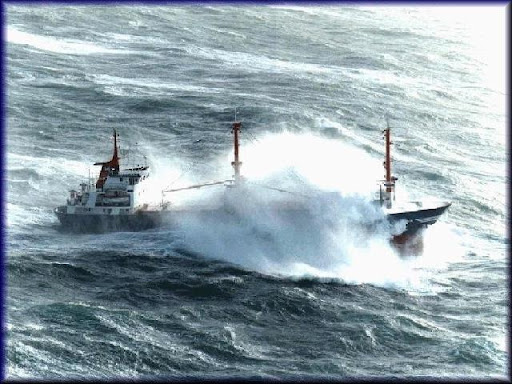
JJ Pronk has a interesting photo collection of ships in heavy weather.


Riverdance ferry floatation trench
By Rob Stocks


A HUGE
trench has been dug alongside the beached ferry Riverdance ahead of a bid to right the ship.The 6,000 tonne roll-on roll-off ferry has been stranded on the sands at Anchorsholme since she ran aground in bad weather at the end of January.

Preparations are now being made to correct her list of more than 90 degrees, including the digging of the trench.

See more information on The Riverdance

View our Shipwreck online special

See The Riverdance webcam

See our Riverdance picture gallery

Tony Redding, of Seatruck Ferries, which operated the Riverdance, said; "We are excavating around the boat to make it easier to move her.

"If you are going to try and right her, you need to have somewhere for her to go.

"This will hopefully make the operation much easier."

Huge containers have also been welded to the port side of the ship to assist in the righting operation.

Mr Redding said: "These are containers which can be filled with water to help bring her level.

"It is all about fine tuning and control.

"We are putting everything in place to make sure we have the best possible chance of bringing her off the beach."

Seatruck and the Dutch salvage team working on the Riverdance had been hoping to right the ship on Thursday.

They are now waiting to see whether severe weather will delay the effort.

Mr Redding said: "It very much depends on the weather.

"We would like to go ahead but if the conditions are like they are in the South West right now, things may not happen.

"We will just have to wait and see what the weather brings."

Coastguard officials have said the salvage operation is going well.

They have no major concerns over the Riverdance despite continued warnings of strong winds.

A spokesman said: "We don't believe the ship is in any danger of moving."

NOAA – ocean observation

The National Oceanic and Atmospheric Administration (NOAA) issued a notice stating that comments on the Integrated Ocean Observing System Strategic Plan should be submitted by April 4. 73 Fed. Reg. 12955 (March 11, 2008).


RS

Tuesday, March 11, 2008

Understanding & predicting severe storms

Understanding & predicting severe storms


According to the Department of Commerce, 42 percent of our gross domestic product is in sectors that are affected by severe weather and climate. Bad weather, or badly forecast weather, means far more than cancelled plans and personal inconvenience. The impact of the weather on our economy, safety, and environment can be severe both through extreme events (hurricanes, tornadoes, floods, drought, etc.) and just day-to-day fluctuations. In the U.S., estimates of average annual damage ($16 billion) and loss of life (1,500) are significant and impact every state. According to the Department of Commerce, 42 percent of our gross domestic product is in sectors that are affected by severe weather and climate. Conversely, good information about weather and climate can be used effectively to enhance economic activities and improve quality of life.

Researchers in NCAR's Mesoscale and Microscale Meteorology Division of the Earth and Sun Systems Laboratory, and in the Research Applications Laboratory, strive to understand the physical processes and genesis of such extreme weather, in order to protect human lives and property.

Studying Severe Storms

  • Thunderstorms

    More than 1,000 thunderstorms rage across Earth's surface at any moment. They bring beneficial rains, but thunderstorms can also spawn lightning, tornadoes, hail, and flash floods. NCAR scientists and their collaborators pry into the heart of thunderstorms using aircraft, balloons, mobile radars, and computer models.

  • Hail

    The pelting chunks of ice known as hail can ruin vehicles and slice plants to ribbons in minutes. Only a few Americans have been killed by hail in recent decades, but a number are injured each year. NCAR researchers have analyzed some of the biggest hailstones on Earth and developed radar-based techniques for spotting hail.

  • Lightning

    Using sophisticated instruments that can track lightning bolts and the electric fields that trigger them, NCAR scientists have learned much about these spectacular, deadly products of thunderstorms.

  • Tornadoes

    More than 1,000 twisters touch down in the United States in a typical year. However, U.S. death and injury tolls have dropped considerably in recent decades due to better warnings. NCAR has joined colleagues to delve into the processes that drive tornado formation and evolution.

  • Floods

    The powerful and deadly force of flash floods is an underrated risk. Even though the U.S. population has nearly doubled since 1950, the death toll from most weather hazards has dropped by half or more, while the flooding toll has risen slightly. NCAR's precipitation research touches on many aspects of the flood threat.

  • Hurricanes and Typhoons

    Tropical cyclones with winds at or above 74 miles per hour (119 kilometers per hour) are called hurricanes in the Atlantic and northeast Pacific, and typhoons in the western Pacific. Sensors and computer models developed at NCAR help track and predict these tropical tempests more accurately than ever.

  • Winter Storms

    Large, complex weather systems can dump snow on one city, coat another with ice, and drench others in rain. These storms are shaped by weather elements that extend from the tropics to the poles and from ground level to the heights where aircraft cruise. NCAR is studying the mechanisms behind our worst winter storms.

WEATHER NOTES

The First Tornado Forecast

March 9, 2008, 10:06 pm | Bill Murray | Weather History

Before a man in the Signal Corps named John Park Finley came along, the tornadoes that occurred on the American Plains were considered to be unforecastable. Finley was allowed to investigate the destructive storms by his superiors. He was assigned to the Weather Research Unit in Washington, D.C.

Finley had studied the atmospheric parameters that were present during previous tornadoes. In 1884, he published his research in the journal Science. Here are those parameters, published in a 1999 Weather & Forecasting article.

1. there is a definite relation between the position of tornado regions and the region of high contrasts in temperature, the former lying to the south and east;

2. there is a similar definite relation of position of tornado regions and the region of high contrasts in dewpoint, the former being, as before, to the south and east;

3. the position of tornado regions is to the south and east of the region of high contrasts of cool northerly and warm southerly winds—a rule that seems to follow from the preceding and is of use when observations of temperature and dewpoint are not accessible;

4. the relation of tornado regions to the movement of upper and lower clouds has been studied and good results are still hoped for;

5. the study of the relation of tornado regions to the form of barometric depressions seems to show that tornadoes are more frequent when the major axis of the barometric troughs trends north and south, or northeast and southwest, than when it trends east and west.

On this date (March 10) in 1884, Finley issued the first experimental tornado prediction, utilizing the parameters. As you can see, they are still accurate and largely in use today. The use of the word “tornado” in forecasts would be banned a few years later. That ban would remain in place until 1952.

MARITIME NOTES

High winds fail to halt Riverdance ferry bid
By Rob Stocks

STRONG winds and high tides will not hamper efforts to salvage the stricken ferry Riverdance. It is now more than five weeks since the 6,000-ton roll on roll of ferry ran aground on the sands at Anchorshome after being struck by a freak wave in the Irish Sea.

See more information on The Riverdance

Hopes are high she can be returned to an upright position this week, despite nightmare weather being predicted today.

View our Shipwreck online special

See The Riverdance webcam

See our Riverdance picture gallery - updated daily

There are severe weather warnings for some parts of the west coast today coupled with a spring tide in excess of nine metres.

But officials from the Coastguard Agency believe they will not cause any worsening in the Riverdance's 90 degree list.

Flotation tanks are now clearly visible on one side of the ferry.

A spokeswoman said: "We are keeping a close eye on the situation at Blackpool.

"Obviously there are going to be some high tides and strong winds.

"We do not however believe that will pose any further problems for the Riverdance. She should not move any further.

"The timetable is still in place for attempts to bring her upright on Thursday."

Despite some reports the Riverdance would be cut up on the sands at Anchorsholme, coastguards and salvage team members are still hopeful she can be towed off in one piece.

A spokeswoman for the coastguard said: "Work on the salvage efforts in going well.

"All the welding onboard is complete.

"It is still the plan to tow her off the sands and the salvage team are confident that can happen."

Met Office officials are expecting the worst of the storms to miss Blackpool, but predict a 20 per cent chance of disruption in North West England as a result of the weather.

People are being urged to stay away from the sea front as strong winds coupled with a high tide could make the area dangerous.

The winds are due to ease across the UK by early on Tuesday.

RS


Monday, March 10, 2008

The Wave That Changed Science New

The Wave That Changed Science

Monday, March 03, 2008 - Ran Levi

Over the centuries many sailors described seeing huge ocean waves, monsters of the seas that towered to heights of 30 meters and more. Those Rogue Waves, as they were called, appeared suddenly and rammed into the unfortunate vessel. Scientists tended to ignore these stories. They considered them to be legends, fairy tales that sailors tell each other to pass the time on long journeys. They had good reason to doubt these stories: contemporary mathematical models predicted that the biggest possible ocean storm wave could be twelve to fifteen meters high.

But those tales, passed from one sailor to another in pubs or late at night on the ship's bridge, told also of a massive ‘hole’ in the water, tens of meters deep. This hole was followed by a nearly-vertical wall of water - a wave so steep no ship could 'climb' it. According to the stories, when a ship was hit by such a wave it usually drowned within seconds.

For a long time, scientists thought their understanding of ocean waves was reasonably good. The way they saw it, the mathematical models that were developed for other kinds of waves, like sound waves and electromagnetic waves, could be applied to waves in the ocean. And why should these models not be appropriate? A wave is just a wave, after all - an interference making its way from point A to point B, energy being transported from one place to another. Based on these mathematical models, scientists believed a thirty meter may exist, but is likely to occur only once every thirty-thousand years. Thus, Rogue Waves reports were placed in the same category sea-dragon stories, Bermuda Triangle oddities, and mermaid tales.

A single wave that crashed on a tall oil-rig in the northern Atlantic Ocean shocked the foundations of these scientific models.

In 1978, the merchant ship ‘Munich’ set sail on a regular voyage across the Atlantic Ocean, transporting goods from Germany to the United States. The Munich was the jewel in the German merchant fleet's crown; it was over two hundred meters long and equipped with the best technology money could buy. No storm or hurricane could possibly harm the Munich.

At 3 A.M, on December 12th, 1978, a Greek ship received an S.O.S message from the Munich. An emergency task force of almost a hundred ships and planes combed the Atlantic, but no trace of the Munich was ever found.

The Munich’s disappearance was a great mystery. The weather had been rough, but should not have posed any serious danger to the large vessel. The matter became even more mysterious when the search party located an empty life boat that had belonged to the Munich, floating in the water. Bent and broken pins on the life boat’s side indicated that the boat was not purposefully lowered to from the ship by the Munich’s crew, but was thrown over-board as a result of a massive impact. However, the Munich’s life boats usually hanged twenty meters above the water's surface! What tremendous force could have reached that height, knocking the raft out of place and possibly sinking the entire ship?

The formal investigation team concluded that the Munich drowned as a result of an unknown weather-related event, but many suspected that a Rogue Wave was the real culprit. Since no proof was available, this view was never adopted by the authorities.

This all changed on New Year’s Eve, 1995.

The North Sea, off the coast of Norway, was angry that day, my friends. Hurricane-strong winds were blowing and twelve meter waves crashed on the Draupner oil rig. The rig’s workers were not worried, because the rig was designed to withstand hurricanes. At roughly 3 p.m. that afternoon, the order was given that all personnel must enter the rig’s structure- no one volunteered to stay outside and watch the ocean.

For this reason, no one saw the monstrous wave that hit the Draupner oil rig at 3:20 pm. The wave did not harm the rig itself (the platform was high above the water), but was recorded by a special laser-based wave-height detector. The rig’s engineers were shocked when they went over the detector's logs. The wave was almost 20 meters high. It was practically impossible- this kind of wave should only occur once every ten thousand years. Yet the laser detector was accurate to within an inch and worked flawlessly. The wave’s existence was undeniable.

Where then did the Draupner Wave, as it came to be known, come from?

It could not have been a Tsunami wave, since Tsunami waves grow large only when approaching land. It could not have been a Tidal Bore, a wave caused by tidal forces, since these only occur near the shore and are a much more localized phenomena.

It became obvious that a new theory must be developed to explain Rogue Waves. The first stage of every theory development is searching for facts. When the researchers looked back at all the data collected from sea buoys and ocean-waves radars, they were amazed at what they found. Instead of one report of a giant wave every thirty thousand years, Rogue Waves seemed to occur very often. Why, then, did ships encounter them only rarely? The answer was obvious- Rogue Waves exist for several minutes only, and disappear almost as soon as they are formed.

It was now also possible to open the history books and re-examine past mysteries in the light of the new knowledge. One such historical enigma is the ‘Flannen Island Mystery;’

In 1899, a new lighthouse was built on a remote group of islands off the coast of Scotland, some 20 miles from the mainland. Three light house keepers were stationed at the lighthouse, and cared for the structure.

A year after the light house was erected, a supply ship came to the islands- as it did every week- to replenish the keepers' food supply. The ship's crew found the light house was empty. Its three keepers had vanished almost without a trace. Upon examining the scene, the ship's crew found that coats had been left behind, and a chair had fallen in the kitchen. These were considered as clues that hinted to a sudden catastrophe.

An examination of the lighthouse itself revealed damage to a metal box some thirty meters above the water's surface, a railing that was bent beyond repair, and a huge rock that was somehow moved from its place.

The official examiner speculated that a giant wave had hit the lighthouse- but since it was considered impossible that a wave this size might exist, alternative theories were invented to explain the men's sudden disappearance. Some speculated a fight had broken out between the keepers, others suggested murder, suicide, abduction by foreign agents, and even abduction by aliens- everything was possible.

It is now believed that two of the keepers were working near the water, when the third spotted a Rogue Wave approaching the island. He ran outside to warn the others, not stopping to pick up the fallen chair or take his coat with him, but the monstrous wave washed all three.

A different, even more famous case involved the ‘Queen Mary’, a giant passenger ship. During the second world-war it was used to transport troops from the U.S. to Europe. In December 1942, with sixteen-thousand soldiers on board, it was hit by a huge wave. This monster wave, almost thirty meters high, crashed into the ship’ side and caused it to reach a 52 degrees tilt.

The ship slowly straightened, and barely managed to sail back to harbor. The engineers who examined the damage remarked that had the ship tilted by just three more degrees it would have capsized, killing everyone on board. This incident had the potential to end so tragically that it would have made the Titanic disaster seem negligible.

Using satellite imagery, it became obvious the there are certain areas around the globe that are more prone to Rogue Wave activity. Places where ocean currents meet waves that travel at opposite directions are especially dangerous. Those areas were quickly removed from shipping lanes listings.

But Rogue Waves occur in other places as well, places that have no strong currents or high waves. Today, the scientists' opinions remain divided as to the source of these waves. Generally speaking, two kinds of theories are competing for supremacy: linear theories versus non-linear theories.

Linear theories explain Rogue Waves as the additive sum of two smaller waves: that is, when a ten meters high wave ‘climbs’ upon another ten meter high wave, we get a single monster wave that reaches a height of twenty meters. For example, it is well know that high frequency waves travel slower over the ocean than low frequency waves. It is possible for a slow frequency series of waves to ‘chase’ and overtake a higher frequency group of waves, and 'climb' over them.

Critics of the linear theories say that these theories can only explain how under a very specific set of circumstances a Rogue Wave is produced. These are circumstances that occur very rarely, and can not account for the high number of Rogue Waves that have been reported over the years.

Non-linear theories take a very different approach. They try to explain Rogue Waves using equations and ideas taken from quantum mechanics. Schrodinger’s Equation, for example, is a famous equation used to explain and predict the behavior of electrons in orbit around the atom’s nucleus. It does so by treating the electrons as waves traveling around the atom. A version of this equation, known as the Non-Linear Schrodinger Equation, is highly effective when used in optics, and - as it turns out- in explaining Rogue Waves. According to this equation, an ocean wave might start to ‘suck’ energy from nearby waves, gaining height at the expense of the surrounding waves. This could account for the ‘hole in the water’ phenomenon reported by sailors who survived encounters with Rogue Waves.

As mentioned above, all Rogue Wave theories are still very much a work in progress. Technological advances might have given us the impression that we have managed to ‘tame’ the sea, that our huge ships and sophisticated radars have made the voyage over the ocean safe, almost boring.

However, nature proves time and again that we are neither as smart nor strong as we like to think we are. At least for the near future, sailors still need to keep their binoculars close at hand, and should keep scanning the horizon for Rogue Waves, and maybe for other sea monsters science has yet to recognize.

WEATHER NOTES

Whirlwind Strikes West Java, destroys 294 houses

March 10, 2008, 9:29 am
Filed under: Storm

Whirlwind devastated at least 294 houses, school and local hospital buildings at Sukabumi district, West Java province, on Friday at 16:15 pm local time, leaving no victims.

The afternoon whirlwind which damaged three villages at Parung Kuda sub district had cost the local population material loss amounting to Rp 369 million, said the sub district officer Tendy Hendrayana.

Hendrayana reported that the whirlwind which struck Bojongkokosan, Langensari as well as Kompa villages, had left hundreds of buildings without electricity for hours.

The local government officers accompanied with villagers had been repairing the devastated buildings, he said.

To date, Sukabumi government and Indonesian Red Crescent Institute (BSMI) had been contributing 600 kg of rice as well as medicines and instant noodles to the villagers.

We urged the government to distribute the assistances to correct the situation, Hendrayana said

Method To Estimate Sea Ice Thickness

ScienceDaily (Mar. 7, 2008) — Scientists recently developed a new modeling approach to estimate sea ice thickness. This is the only model based entirely on historical observations.

The model was developed by scientists with the U.S. Geological Survey and the Russian Academy of Sciences, Moscow.

Using this new technique, the thickness of Arctic sea ice was estimated from 1982 to 2003. Results showed that average ice thickness and total ice volume fluctuated together during the early study period, peaking in the late 1980s and then declining until the mid-1990s. Thereafter, ice thickness slightly increased but the total volume of sea ice did not increase.

Scientists propose that the volume stayed constant during the study's latter years because while the ice was thickening in the high latitudes of the Arctic, the surrounding sea ice was melting. Sea ice, however, can only become so thick, and if Arctic sea ice continues to melt, the total volume of sea ice in the Arctic will decrease.

The most dramatic losses in sea ice cover have occurred since 2003, and as scientists acquire newer data, they will apply the new model to study recent years of ice thickness and volume change.

This modeling approach uses sea ice motion data to follow parcels of ice backward in time at monthly intervals for up to 3 years while accumulating a history of the solar radiation and air temperature to which the ice was exposed. The model was constructed by fitting these data with an ice parcel's known thickness to determine how the thickness of sea ice changes in response to different environmental conditions. Data on the known thickness are obtained from measurements by submarine cruises and surface coring missions.

"Sea ice is affected by the accumulation of environmental factors to which it has been exposed," said USGS Director Mark Myers. "Understanding the natural variability of sea ice thickness is critical for improving global climate models. Sea ice regulates energy exchange and plays an important role in the Earth's climate system."

This model, built on historical observations, complements thermodynamic models that simulate ice thickness. Science benefits from having different models. Comparing different model outputs can help improve predictive capabilities. Many scientists worldwide are using satellite and ground observations of the Arctic's atmosphere, ice and ocean to gain a better understanding of how changes at the top of the world affect ecosystems both locally and globally.

The report "Fluctuating Arctic sea ice thickness changes estimated by an in-situ learned and empirically forced neural network model" was recently published in the Journal of Climate and can be found at the American Meteorological Society's journal site.

Adapted from materials provided by United States Geological Survey.


MARITIME NOTES

Then and Now: Under the Riverdance ferry


THOUSANDS
of visitors - and locals - are still flocking to the seafront to view the stranded ferry Riverdance.
But when they walk along Princess Way how many know what lies beneath their feet?

The answer is the former Little Bispham underground car, with spaces for 90 cars, which opened in 1935.


Passers-by might see metal doors at the bottom of a slope but will have no idea how big the subterranean space is.


Memory Lane reader John Knowles, now 77, recalls that before the Second World War his family had a box type Austin and they went down to the beach for a walk and a picnic with sandwiches and, his favourite, a bottle of Tizer. It was quite exciting, he says, as a young boy, to be driven into an underground car park.


Edmund Wynne, former "father" of Blackpool Council, and real-life dad of current Mayor Robert Wynne, actually ran the underground car park, as well as the
West Street multi-storey, when he took over the lease of several council car parks in the early 1960s.

He paid the council an annual rent of £10,000, immediately cut the charges to motorists and managed to turn a £15,000 loss into a profit, giving his staff, mainly ex-servicemen, a regular bonus.


Edmund says some councillors thought he was out of his mind but he knew he could do it.


The council eventually voted to take the lease back and, as he says, car park prices rocketed.


These days the huge vault is leased to Fylde Boat Angling Club to store boats, tractors and other equipment.


And if motorists were down there, not only would they get a ticket from a warden for overstaying their time, but there would also be a free car wash as the high tide floods up through the drains twice a day!


RS

Friday, March 7, 2008

Innovation: Tsunami Detection by GPS

Innovation: Tsunami Detection by GPS

How Ionospheric Observations Might Improve the Global Warning System


INNOVATION INSIGHTS with Richard Langley

THE TSUNAMI generated by the December 26, 2004, earthquake just off the coast of the Indonesian island of Sumatra killed over 200,000 people. It was one of the worst natural disasters in recorded history. But it might have been largely averted if an adequate warning system had been in place.

A tsunami is generated when a large oceanic earthquake causes a rapid displacement of the ocean floor. The resulting ocean oscillations or waves, while only on the order of a few centimeters to tens of centimeters in the open ocean, can grow to be many meters even tens of meters when they reach shallow coastal areas. The speed of propagation of tsunami waves is slow enough, at about 600 to 700 kilometers per hour, that if they can be detected in the open ocean, there would be enough time to warn coastal communities of the approaching waves, giving people time to flee to higher ground.

Seismic instruments and models are used to predict a possible tsunami following an earthquake and ocean buoys and pressure sensors on the ocean bottom are used to detect the passage of tsunami waves. But globally, the density of such instrumentation is quite low and, coupled with the time lag needed to process the data to confirm a tsunami, an effective global tsunami warning system is not yet in place.

However, recent investigations have demonstrated that GPS might be a very effective tool for improving the warning system. This can be done, for example, through rapid determination of earthquake magnitude using data from existing GPS networks. And, incredible as it might seem, another approach is to use the GPS data to look for the tsunami signature in the ionosphere: the small displacement of the ocean surface displaces the atmosphere and makes it all the way to the ionosphere, causing measurable changes in ionospheric electron density.

In this month's column, we look in detail at how a tsunami can affect the ionosphere and how GPS measurements of the effect might be used to improve the global tsunami warning system.

"Innovation" is a regular column that features discussions about recent advances in GPS technology and its applications as well as the fundamentals of GPS positioning. The column is coordinated by Richard Langley of the Department of Geodesy and Geomatics Engineering at the University of New Brunswick, who welcomes your comments and topic ideas. To contact him, see the "Contributing Editors".

The December 26, 2004 earthquake-generated Sumatra tsunami caused enormous losses in life and property, even in locations relatively far away from the epicentral area. The losses would likely have never been so massive had an effective worldwide tsunami warning system been in place. A tsunami travels relatively slowly and it takes several hours for one to cross the Indian Ocean, for example. So a warning system should be able to detect a tsunami and provide an alert to coastal areas in its path. Among the strengths of a tsunami early-warning system would be its capability to provide an estimate of the magnitude and location of an earthquake. It should also confirm the amplitude of any associated tsunami, due to massive displacement of the ocean bottom, before it reaches populated areas. In the aftermath of the Sumatra tsunami, an important effort is underway to interconnect seismic networks and to provide early alarms quantifying the level of tsunami risk within 15 minutes of an earthquake. (Continued)


WEATHER NOTES

Second Spring Flood Outlook Released March 7

The second 2008 Spring Flood Outlook was released March 7, 2008 and indicates a high flood potential for streams across northern Illinois and northwest Indiana this Spring. The area of greatest concern for snowmelt flooding includes the Rock, Pecatonica, and upper Fox rivers in northern Illinois. Moderate to major flooding is possible along portions of the Rock and Pecatonica rivers. In addition, due to the already saturated conditions, flooding will continue on the Kankakee River in northwest Indiana.


The complete report can be viewed here.

We also urge those with river interests to view our Advanced Hydrologic Prediction Service (AHPS) web pages, for the latest river stages and river forecasts and probabilistic flood outlook information.

The amount or severity of spring flooding depends on the following factors:

  • Current snow depth
  • Liquid equivalent of the snow
  • Current river levels and streamflow
  • Melting rate (how fast the snow melts)
  • Future precipitation
  • Soil moisture and frost depth
  • Ice jams (can lead to flash flooding)

Additional Spring Flood Outlook information is available from the North Central River Forecast Center.

The next scheduled spring flood outlook with be issued on Friday, March 28th.


Bad weather brings delays and destruction

By Ian Johnston

Last Updated: 12:31am GMT 02/03/2008

Tens of thousands of rail travellers face continuing delays today after gales of up to 84mph in the early hours of yesterday led to a major route becoming blocked.

Containers were blown off freight trains, badly damaging the West Coast Mainline in two locations.

The storm also caused the destruction of two new multi-million pound cranes at the port of Felixstowe when a Chinese container ship, which had just delivered them, broke its moorings at about 1.30am yesterday morning.

A 67-year-old woman who was crushed by a falling tree near Cleveland on Friday was in a critical condition in hospital yesterday while buildings near the epicentre of Wednesday's earthquake in Lincolnshire were damaged again. (Continued)


Tuesday total: 4 tornadoes
By STEVE LYTTLE

The National Weather Service offices across the Carolinas said surveys show four tornadoes touched down Tuesday during severe weather which affected the Southeast.

All of the tornadoes were relatively weak, and no injuries were reported.

Two of the twisters touched down not far from the Charlotte area.

The National Weather Service in Columbia says a tornado reached the ground about 4:40 p.m. Tuesday 4 miles east-northeast of Great Falls, about 55 miles south of Charlotte. The storm was estimated to have an F0 intensity (the weakest on the Fujita scale, which ranks tornado intensity from F0 to F5). Meteorologists say the Great Falls tornado was on the ground for about a mile and was 40 yards wide. It damaged trees in its path.

The same storm was responsible for a tornado warning issued a short time later in Lancaster County, but there is no confirmation that the twister touched down there.

A second Charlotte-area tornado was in Davie County, about 30 miles east of Statesville. The National Weather Service office in Greer, S.C., said this storm, also an F0, touched down in the Cornatzer community and was on the ground for about 2/3 of a mile. It was about 25 yards wide and struck about 6 p.m.

The Davie County tornado had top winds of 70 to 80 mph and damaged a mobile home and several other buildings.

The other tornadoes were in Prosperity, S.C., and in Alamance County of North Carolina.

The Prosperity storm struck about 4:20 p.m. and was an F1. It also damaged trees. Prosperity is near Newberry, S.C., northwest of Columbia.

The Alamance County tornado struck in the early evening hours and was an F0, about 100 yards wide. This storm was on the ground for 5 miles and damaged a number of buildings in Alamance and Caswell counties, near the North Carolina-Virginia line.


March 2-8 is Severe Weather Preparedness Week

Tornadoes can strike at anytime, day or night, but can be especially deadly in the middle of the night when many people are asleep. The Illinois Emergency Management Agency (IEMA) and the National Weather Service (NWS) are reminding people that weather radios save lives by providing round-the-clock alerts of imminent dangers (read press release).

The Illinois Emergency Management Agency (IEMA) has developed a Severe Weather Preparedness document with tips on staying safe during the severe weather months.


Senate hearing on NOAA budget

On March 13, the Subcommittee on Oceans, Atmosphere, Fisheries, and Coast Guard of the Senate Committee on Commerce, Science & Transportation will conduct an oversight hearing on the National Oceanic and Atmospheric Administration Budget. (3/5/08).

Freague Waves on Global Warning Consensus, what consensus?


MARITIME NOTES

Coast Guard helps save 72-foot tanker that was taking on water
Leanne M. Robicheau

PORTLAND, Maine --A tanker that began taking on water 35 miles off the coast of Maine has been saved from sinking with help from the Coast Guard. The 72-foot island tanker William McLoon is currently in Portland, where it towed by the Coast Guard for repairs.

The drama unfolded Tuesday night when the tanker's three-man crew reported a flooded engine room.

Chief Warrant Officer Curtis Barthel says there was about three feet of water in the engine room and water on the deck, and the crew didn't know where it was coming from.

Three Coast Guard boat crews and two air crews responded. The Coast Guard delivered a water pump and a rescue crew assisted in keeping the tanker afloat.

The Coast Guard says the tanker was headed to Florida when it encountered problems. It arrived in Portland on Wednesday for inspection and repairs.


Russian ship Pallada enters Panama Canal on round world trip

http://www.marinebuzz.com/marinebuzzuploads/RussianSailShipPalladaonWorldTour_13836/Pallada_01.jpg


27/02/2008 14:11 VLADIVOSTOK, February 27 (RIA Novosti) -

The Russian sailing ship Pallada entered the Panama Canal on Wednesday as part of its journey around the world, a spokesman for the vessel's owner said on Wednesday.

"The ship will sail from the Pacific to the Atlantic in around 14 hours," he said, referring to the trip through the Panama Canal.

The frigate of the Far Eastern State Technical Fishing University departed from Vladivostok, Russia's largest port on the Pacific, on November 2, 2007.

The trip is dedicated to the 190th anniversary of the world-round trip performed by Russian ships led by Faddei Bellinsgauzen and Mikhail Lazarev, as well as 50 years of Russian research in Antarctica.

The spokesman also said the vessel would later drop anchor in the Caribbean to get drinking water and food. The ship is then due to arrive in Caracas, Venezuela on March 4. It is then scheduled to leave for Cuba two days later.

The ship, with 121 marine cadets on board, is to cover 32,800 nautical miles and visit 22 countries in 9 months.

The three-mast Pallada is listed in the Guinness Book of Records as the fastest sailing vessel in the world, with a speed exceeding 18 knots.

The sailing ship, the winner of many international festivals and races, has performed over 100 international trips over 13 years. It has also been visited by many famous people, including Jackie Chan and Arnold Schwarzenegger.

GAO Evaluates Coast Guard's Shift to Homeland Security GAO | Download Full Report

The Deepwater Program is intended to replace or modernize 15 major classes of Coast Guard assets–including vessels, aircraft, and communications systems. At the program's start, the Coast Guard chose to use a system integrator, Integrated Coast Guard Systems, to design, build, deploy, and support Deepwater in a system-of-systems approach. In a series of reports, we have noted the risks inherent in this approach.

With the Deepwater program under way, the Coast Guard's priorities and focus shifted after September 11 toward homeland security missions, such as protecting the nation's ports and waterways. The 2002 Maritime Transportation Security Act and the 2006 SAFE Port Act required a wide range of security improvements. GAO is monitoring the acquisition of Deepwater and the Coast Guard's ability to carry out its numerous missions. This testimony addresses:

Nautical Anchor

Messing About In Ships Episode # 14
March 7, 2008, 4:27 am
Filed under: podcast, shownotes

Messing About In Ships podcast episode #14 has launched.

(38 minutes)

Download MP3 file: Messing About In Ships Episode # 14

Show Notes coming soon!

Subscribe Via iTunes HERE


Have a great weekend!
RS